“I Like to Move It”

As mentioned in the portal of Convention on Biological Diversity, Madagascar is a megadiverse country with a high concentration of endemic species. Its ecosystems include many types of forests, savannah, steppes, rivers, lakes, wetlands, mangroves, drylands and reefs. Currently, these unique ecosystems are home to approximately 12,000 species of vascular plants (96% endemic), 586 species of ferns (45% endemic), 194 species of palms (97% endemic), 1000 species of orchids (85% endemic), 389 species of reptiles (90% endemic), 278 species of amphibians (100% endemic), 282 species of birds (37% endemic), 159 species of fish (66% endemic), 104 species and subspecies of lemurs (100% endemic), 60 species of non-flying small mammals (92% endemic), 43 species of bats (73% endemic) and 13 species of carnivore (77% endemic).

Between 7th and 17th April of 2025, I explored some part of Madagascar including 16 various ecotourism destinations in wet and dry zone of the country. As per One Earth portal, the Madagascar bioregion, part of the Madagascar and Eastern Afrotropics subrealm located in the Afrotropics realm, is separated from the African continent by the Mozambique Channel dominated by humid tropical forests in the east, drylands in the south, and dry forests in the north. The bioregion contains eight ecoregions—Madagascar Humid Forests, Madagascar Subhumid Forests, Madagascar Dry Deciduous Forests, Madagascar Ericoid Thickets, Ile Europa and Bassas Da India Xeric Scrub, Madagascar Spiny Thickets, Madagascar Succulent Woodlands, and Madagascar Mangroves — with a total land area of more than 59 million hectares, making it the fourth largest island in the world.

Aerial view of Madagascar

Out of these eight ecoregions, my exploration covered four ecoregions such as Madagascar subhumid forests, Madagascar humid forests – together in general term called as wet zone and Madagascar succulent woodlands and Madagascar spiny thickets – together in general term called as dry zone.

Exploration Map between 7th and 17th April 2025

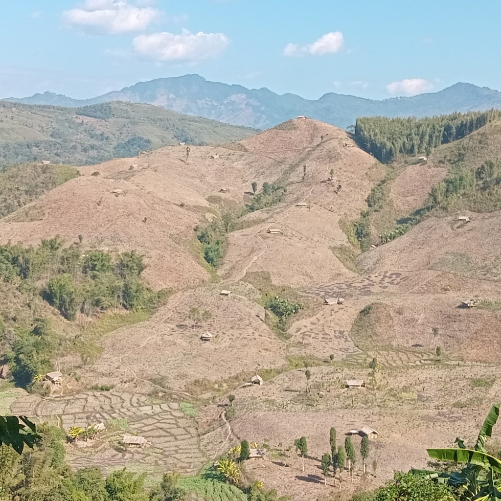
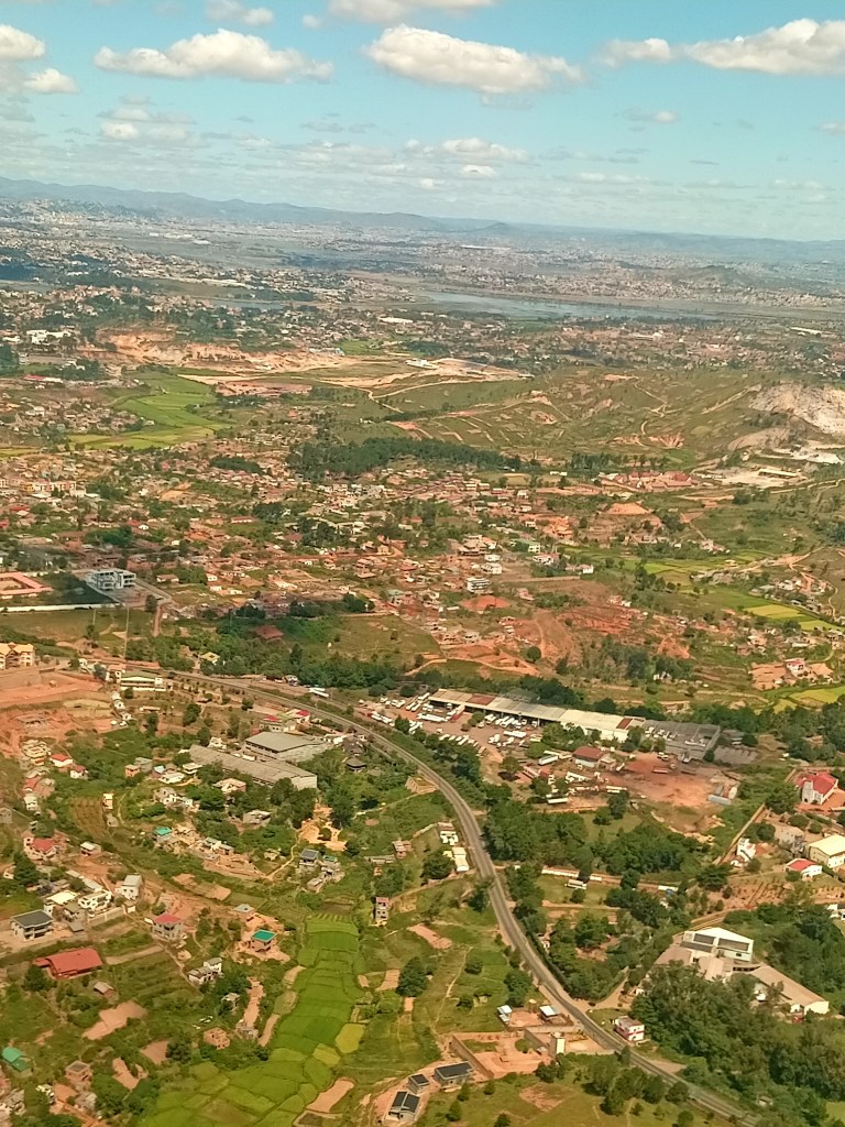
I reached Madagascar on 6th April afternoon after change of three flights, from Delhi to Mumbai and then to Adis Ababa and finally to Antananarivo, the capital of Madagascar, or commonly known as Tana. In the morning of 7th April with my local guide John Razafindrakoto from Get Your Guide, after a 65 km of road drive through country side which often turned-out as bumpy ride with multiple off roading, I reached at Mantasoa Lake. As per original schedule we were supposed to start at 7 am, but due to miscommunication between Get Your Guide and John we could eventually start at 9:30 am. In order to explain reason behind dusty and broken condition of road, on the way to Mantasoa, John was telling me, how the current Government is indifferent about infrastructure development in Madagascar. Madagascar’s overall poor infrastructure is negatively affecting its economic growth and development opportunities. While 70 % of primary roads are in good condition, about two-thirds of secondary and tertiary roads are estimated to be in poor condition (as per World Bank report, 2018). In 2018, the World Food Programme and the Global Logistics Cluster classified 64 % of roads in Madagascar as in poor driving condition, 28 % in average condition, and 10 % in good condition; seven-in-ten of the primary roads fall into the latter-most category, which is defined as being navigable throughout all seasons of the year. As natural gravel is not regularly available on the island of Madagascar, many roads are composed of sand lined with crushed stone, (de O.S. Horta, Jose Carlos; Traverso, Carlo R. (1991). “Deterioration and rehabilitation of earth roads in Madagascar”).

Lake Mantasoa

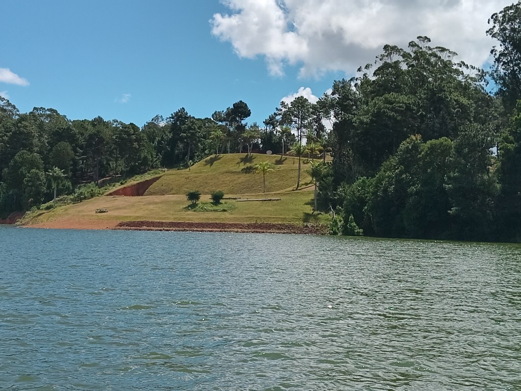
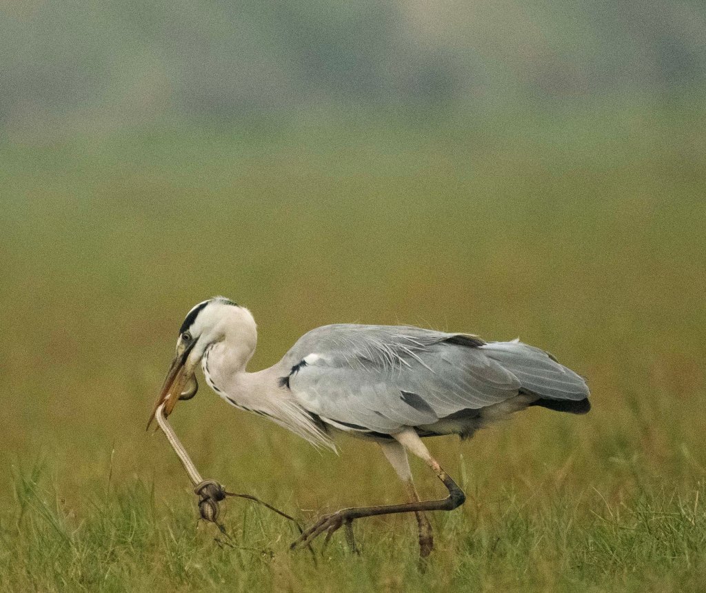
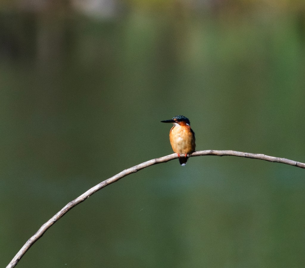
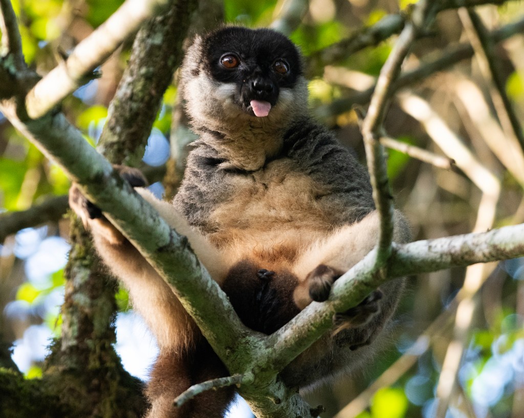
Lake Mantasoa is a large artificial lake with a surface area of 20.05 km2, created by the Mantasoa Dam on the Varahina river (an affluent of the Ikopa) in the municipality of Mantasoa, Analamanga region of Madagascar. It provides immediate irrigation for Betsimitatatra paddies in Analamanga and tabbed water for the capital Antananarivo. The water temperature reaches up to between 13–22 degrees in winter. The lake’s lack of basal microfauna and ferruginous soil provides clear water. While entering the lake area I had my first sighting of Malagasy kingfisher and African stonechat. Although my first sighting of endemic birds of Madagascar had happened in the backyard of San Cristobol Hotel near Tana airport, where I stayed for couple of days. Those were red fody or Madagascar fody and Madagascar wagtail. While crossing the lake on a boat to reach the Nosy Soa park we saw a flock of White-faced whistling duck. Approximately ten-fifteen minutes of boat ride took us to Nosy Soa Park which is a naturalized zoological garden on an island half way along the Great Lake of Mantasoa. Built on an island of one kilometer in circumference in the heart of the lake, the private reserve of Nosy Soa has for main objective the reconstitution of a natural space too often ravaged by human. The fauna and flora have been successfully reintroduced since 2002, transforming the place into a very pleasant zoological garden with an educational vocation. Five species of lemur such as ring-tailed, Coquerel’s sifaka, black and white ruffed, Eastern bamboo and common brown lemur – which were rescued from forest and some of them were bred in captivity could be easily spotted around the park. I also got so see fascinating O’Shaughnessy’s chameleon and giant hog-nosed snake, poisonous Mantella and tomato frogs. Of course, everything was in semi-wild condition kept within a naturally created and anthropogenically transformed habitat.

Malachite Kingfisher

After all these experiences, again after a long drive through bad road, I reached at my hotel at around 7:30 pm. By that time some of our exploration team members had already arrived who were also staying in same hotel. Our main exploration was supposed to start from 9th April. I reached couple of days earlier to see few more ecotourism destinations as it was my first trip to Madagascar and only second to Africa. The exploration was organized by Bangalore based ecotourism and wildlife photography company Darter Photography in collaboration with local Madagascar based ecotour company Cactus Tour. Therefore, my good friend and CEO of Darter Photography, M.V. Shreeram was leading the exploration assisted by a PhD scholar in evolutionary biology and herpetologist Achyuthan Srikanthan. The retired Chief Naturalist of Karnataka’s Jungle Lodge Resort group (JLR), Karthikeyan Srinivasan was also part of that group.

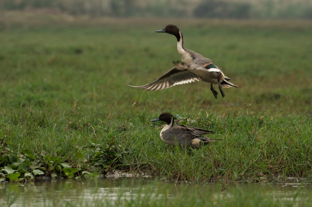
On 8th April morning at 7:30 am, Shreeram, Achyuthan, Karthikeyan and I went for another exploration before our main exploration had started. Located in the heart of Antananarivo, the Tsarasaotra park is known for its 14 species and subspecies of endemic and threatened waterbirds. As the first private Ramsar site in Madagascar, it offers a glimpse into the richness of Malagasy avifauna. The Site consists of a lake of around ten hectares, with an islet, flood zones and wooded edge. The lake is surrounded by eucalyptus and camphor trees, as well as Juncus and Cyperus reeds. It plays an extremely important role in providing a refuge and nesting site amid the urban environment to waterbirds such as herons and ducks. Particularly during the hunting season, the Site is key to the survival of 14 threatened waterbird species and subspecies endemic to Madagascar. It is the only known site on the Malagasy highlands to host the endangered Madagascar pond heron (Ardeola idae), and it is also home to the endangered Meller’s duck (Anas melleri) and the vulnerable Madagascar grebe (Tachybaptus pelzelnii). The lake is privately owned, and a management plan is not yet available to address the eutrophication and erosion problems that are reducing the lake’s surface area and degrading its water quality.

Day gecko

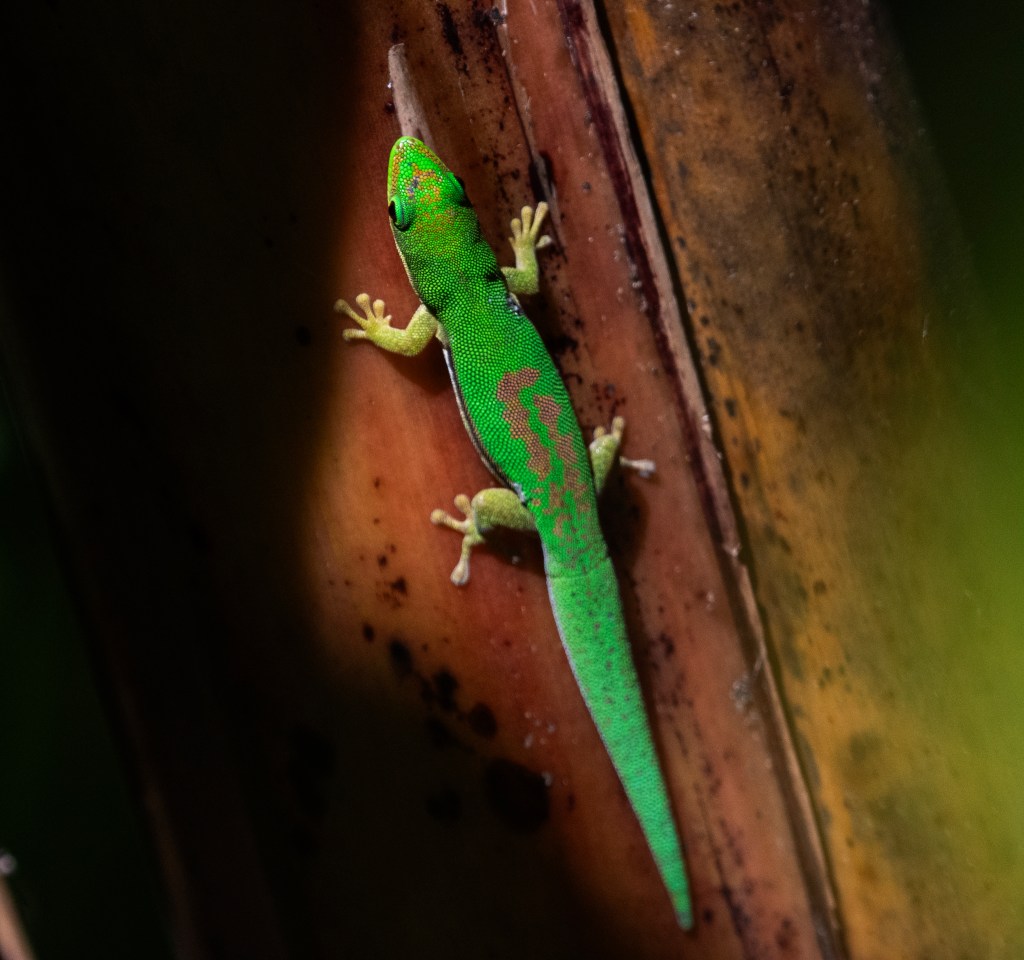
During our three hours of exploration, there we spotted various bird species including black heron, red and blue billed teal, Malagasy white eye, Madagascar hoopoe etc. Some phenomenal reptile sightings were Madagascar day gecko and Lined day gecko.

Our actual exploration started from 9th April, when we started for Andasibe at around 8:30 am. We were 8 people from India, and joined by our local Malagasy nature guide from Cactus Tour – Nandih. We reached at Andasibe at around 1:30 pm. Then after lunch we explored VOIMMA National Park until 5 pm. Then after a quick break and checking in hotel we did a couple of hours of night walk in the park between 6 pm and 8 pm.

VOI M.M.A (Vondron’Olona Miaro Mitia Ala, meaning “the villagers who love and protect the forest” is a community-managed reserve located in Andasibe, about 1.5 km from the Analamazaotra National Park, in the Andasibe region of Madagascar. Created in 2012 by local villagers, this initiative aims to offer a community-based alternative to the nearby national park, while promoting ecotourism and the conservation of primary forest. In short, VOI M.M.A is another forested area in the Andasibe region, managed entirely by the local community and adjacent to the national park. The reserve covers about 0.4 km² of protected primary forest. It is managed by the villagers, and the income generated helps fund community projects such as access to clean water and support for the local health center. The park is well known for sightings of the indri-indri, the largest of all lemurs, but visitors can also encounter the diademed sifaka, the woolly lemur, various frog species (such as Boophis pyrrhus and Boophis viridis), chameleons (Furcifer willsii, Calumma parsonii), geckos (including the famous Uroplatus phantasticus), and unique insects like the giraffe weevil. The flora is just as impressive — a dense, untouched primary forest perfect for nature lovers and botany enthusiasts.

Largest living Lemur – Indri

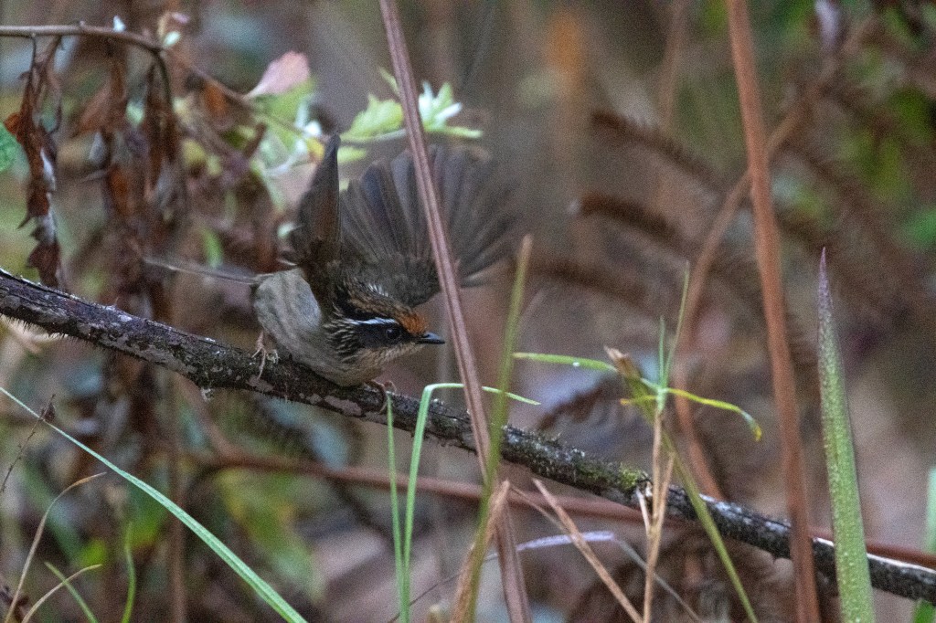
Moment, we entered into the forest during afternoon exploration, we spotted Madagascar paradise flycatcher. Other bird species spotted were Speactacled tetraka, Souimanga sunbird, Nelicourvi weaver etc. But of course, the highlight of the day was sighting of largest species of lemur survived in wild – Indri lemur. Besides that, we also saw common brown lemur. Other highlights were spotting of Parson’s chameleon, mossy leaf-tailed gecko and satanic Leaf-tailed Gecko (Uroplatus phantasticus). Among many insects we spotted there during afternoon and night exploration, the mention worthy was colorful giraffe necked weevil. During night exploration, one more lemur species were added in our lemur sighting list – the mouse lemur.

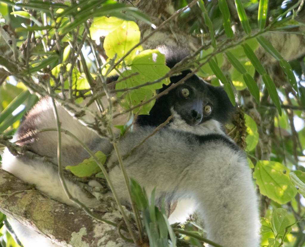
Next day, on 10th April, our exploration area was Analamazaotra National Park, from 8 am to 12:30 pm. The park is in the eastern portion of Madagascar’s Central Highlands. The neighbouring Analamazaotra Forest Station is a local reforestation effort. It adjoins Andasibe-Mantadia National Park to the north. The reserve is situated in the region Alaotra-Mangoro, close to Moramanga and Andasibe. There we had our first encounter with snakes of Madagascar – Pseudoxyrhophus snake, Fandrefiala (Ithycyphus miniatus), and Malagasy rat snake. The new lemur species added in list was Diademed sifaka.
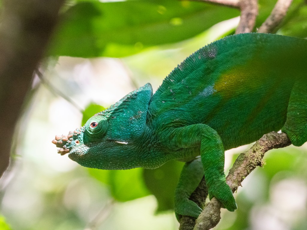
Person’s chameleon

After lunch break the next destination of the day was lemur’s island, which was similar to Nosy Soa but wilder and bigger. I said wilder because of its high canopy tree and less human intervention. Lemur island is a sanctuary for injured or unwanted pet lemurs. A wide water channel surrounds the island for their own safety. We crossed the channel in a plastic kayak, quickest kayak trip I ever did. One mention worthy bird species immediately after entering into the park we spotted was cuckoo roller. The lemur species we got to see there were black and white ruffed, red ruffed, red-bellied lemur and Eastern grey bamboo lemur.

That day we did night walk at Mitsinjo reserve near Analamazaotra, from 6 pm to 8 pm. Heterixalus madagascariensis or the blue back reed frog, Boophis Pyrrhus, golden mantella (Mantella aurantiaca), and Aglyptodactylus madagascariensis or the Madagascar jumping frog were some of the amphibians we saw there. First time we saw woolly lemur during our night walk. the Mitsinjo Reserve is a community-managed protected area, situated right next to the entrance of the Analamazaotra-Andasibe National Park. It is managed by the Mitsinjo Association, a community-based organization founded in 1999 by local residents with the goal of protecting the surrounding rainforest and wetlands. According to available information, the association also manages the Analamazaotra Forest Station independently of the national park, in collaboration with local communities. The Malagasy word Mitsinjo means looking ahead or planning the future.

Diademed sifaka.

Next day, 11th April was all about long road trip from Andasibe to Antsirabe, via Tana. We started at 7:30 am and reached in hour hotel at 8:30 pm. In Madagascar, Antsirabe is known for its relatively cool climate (like the rest of the central region), its industry and the high concentration of pulled rickshaws or Pousse-Pousse. That reminded us about Eastern Indian city Calcutta and neighboring country Bangladesh. Antsirabe attracts around 30,000 tourists a year. After a night halt in Antsirabe next day morning we headed for Ranomafana National Park. We started at 7:30 am and on the way we stopped by at Manandona community forest by the river Manandona, at around late afternoon. It is located at about 23 km south of Antsirabe on the RN 7, a primary highway in Madagascar running 980 km from the capital Antananarivo to Tulear at the South-West coast of the country. The Manandona river flows by this town. Highest Point of the commune is the Mont Ibity with 2250m, which is a tourism attraction point for local people and a customary stoppage cum bio break point for foreigner tourists.

The majority – 90% of the population of the commune are farmers, while an additional 10% receives their livelihood from raising livestock. As they know, international tourists would stop at this point therefore, they were prepared to welcome them in an unusual way. Tourists correlate Madagascar with its diversified, colorful and unusual looking chameleons. When we arrived at that point and got down from our twelve-seater traveler, we were astonished to see around 10-15 kinds with few adult male and female locals were waiting for us, holding twigs in their hands. All the twigs had at least one chameleon each, of different color. They were providing photo opportunities to foreigners in exchange of some money. Based on the conversation Nandih had with those kids and their adult companions, all those chameleons were captured from their farming lands and kept as pet. They keep them as long as these reptiles are healthy enough to remain as photography subjects and then leave them in farm or at roadside to die. And this cycle continues for ever to support their desperate effort to survive hunger and poverty. This is how human hunger, and poverty can accelerate extinction of other non-human species. Achyuthan identified most of those colorful chameleons were Calumma glawi, already declared as Endangered species by IUCN.

Ecotourism vs Ecocide in Northeast Hills of India

In spite of traditionally embracing shifting or jhum cultivation by majority of Naga tribes, which promotes sustainable land use and biodiversity, the forest and biodiversity are under threat in this northeast hill land. Nagaland boasts of the tallest rhododendron and the tallest rice plant in the Guinness book of world records, Naga King chilly is a contender for being the hottest chilly in the world. There are numerous rare and endangered species of plants; Blythe’s Tragopan, the state bird and the Mithun, the state mascot are themselves rare species in the world.

Jhum cultivation in Naga hills

“Deforestation on a hilly state like Nagaland often irreparably damages the local ecosystem leading to the loss of native flora and fauna.”, mentioned in an article published in The Morung Express, written by Chizokho Vero. The age-old development versus environment debate has always put environment in losing side. That was not an exception in this land of indigenous people. Despite witnessing the terrible impacts in Malayasia and Indonesia, the notorious Palm Oil menace has been allowed to make an entry in this part of subcontinent as well. As per an article published on 31st August online edition of The Morung Express, by Moa Jamir, “Oil palm plantation area in Nagaland has increased from 140 hectares (ha) in 2015-16 to 4,623 ha as of March 31, 2021. As per the Department of Agriculture (DoA) document, the State Government has further set a target of 15,000 ha for its cultivation. With the Union Cabinet approval for the implementation of a new Centrally Sponsored Scheme (CSS) called the National Mission on Edible Oils – Oil Palm (NMEO-OP), with special focus on the Northeast and the Andaman region on August 18, the area may increase further.”

According to this article, Member of Parliament from Nagaland, Ms. Tura Agatha Sangma, wrote a letter to Prime Minister of India expressing her concerns over imposing this programme, by stating, “introduction of the “foreign species” in the region would create irreparable ecological imbalance, distort the ground water table and “wreak havoc on the social fabric” in the pre-dominantly tribal community-based society.”

“Large-scale mono-cropping cannot and will not be sustainable for Nagaland’s already vulnerable biodiversity. Clearing large areas of forests and growing the same type of crop/plant will annihilate the remaining diverse species of flora and fauna, that too as identified by the world are endemic and found nowhere in the planet,” asserted Abokali Jimomi, who promotes local products, organic and sustainable farming, as mentioned in Moa Jamir’s article.

Local fruits and vegetables market of Nagaland

India is the world’s largest importer of palm oil, hence one of the main contributors of forest and biodiversity loss in Malaysia and Indonesia. There is a very interesting research paper published by Ward Berenschot and others from Royal Netherlands Institute of Southeast Asian and Caribbean Studies (KITLV), in May 2022, Volume 31 of Geoforum. The title of paper is “Anti-Corporate Activism and Collusion: The Contentious Politics of Palm Oil Expansion in Indonesia”. The authors studied and documented 150 conflicts between rural Indonesians and palm oil companies in four Indonesian provinces (West Kalimantan, Central Kalimantan, Riau and West Sumatra). They found that palm oil conflicts generate a particular ‘rightless’ form of collective action. Instead of invoking legal provisions or rights, communities often avoid formal institutions while adopting largely accommodative forms of protest aimed at improving their bargaining position vis-à-vis companies. Despite regular and intense protests often directed at local governments, their study found that in 68% of the studied conflicts communities fail to address their grievances. Authors’ argument was that this limited success is not just due to the inadequacies of legal frameworks but also to the way in which Indonesia’s informalized state institutions foster collusion between powerholders and palm oil companies. Such collusion has facilitated the repression of protests and undermined the effectiveness of conflict resolution mechanisms.

Thus, the crony capitalism played a definitive role in such large-scale ecocide caused by the palm oil menace. The same argument could be applicable for Nagaland and other part of Indian northeast hill as well. In the 24th June 2024, online edition of Northeast Live, an alarming news was published stating that state of Meghalaya has lost 17,100 hectares of forest land in six years from 2014 to 2020, as announced by H.C. Choudhary, the Principal Chief Conservator of Forest of the state. In another report published in 22nd December 2024, online issue of Business Standard, Meghalaya saw an 84 square km decrease in forest cover between 2021 and 2023 as per latest India State of Forest Report (ISFR). The report also says, except for Sikkim, which reported an increase of 2 square km forest cover, all other states in the northeast region witnessed a reduction of the area under forests.

Depleting Naga Forest a view from Mon village

The Business Standard report mentioned that the ISFR study did not specify what caused the loss of forest cover in Meghalaya, forest officials in the state said human activities, including agricultural expansion, increased settlement and infrastructure development are suspected to be the reasons. However, in a subtle way the report indicated towards jhum cultivation, as one of the probable contributing factors – “Widescale jhum cultivation holds cultural and economic importance for local communities; its ecological costs are immense.”  Exactly what British government did in colonial India to cover up their uncontrolled timber logging and ban jhum cultivation in order to increase yield of crops.

Destruction of hills in Meghalaya for mining and road construction

However, I saw through my own eyes what caused and still causing the loss of forest cover in Meghalaya, when I explored upper Shillong, Mawphlang, and Cherrapunji between 5th and 7th January 2025 with my local nature guide Pallav Pranjal. We started from Guwahati at as early as 4:30 am to ensure reaching at Upper Shillong area, just before dawn. The forest on the both side of Shillong peak hiking trail, in Ri Bhoi forest division of Meghalaya, was covered with early morning light mist. The presence of mist was a barrier for winter morning sunshine to caress the canopy of northeast rain forest. That made the weather chilly and us a bit reluctant in exposing our fingers to operate camera. However, a repeated and fanatic, shrill “queek, queek, queek” sound put us on alert. It was elusive Assam laughing thrush. Upon hearing the call, we aimed our cameras to the source of it. But the bird was too quick to get captured. We saw it flew across from one aide of our trail to another side. After few unsuccessful attempts of locating the bird one more time, we decided to ascend another trail through dense bush and thorny forest floor which was still wet due to last night’s dew, hence slippery as well. We had to stop again after a while upon hearing sound of flattering wings and noticing rapid movement through thorny and leafy lower branches of a shrub. That was a flock of rusty-capped fulvetta. And we were lucky that time to get about thirty minutes or more to take enough photos of the flock.

Rusty capped fulvetta

Couple of hours later we started driving again towards Mawphlang and there we explored the sacred forest and the surrounding forests of Lawkyntang, up to noon. The exploration was quite productive with some fabulous sighting and shooting of grey sibia, crested finch bill, spot breasted parrotbill, spot breasted scimitar babbler and few other birds. After that it was time to take break from field work and checking in hotel for shower and lunch. Around 2 pm again we started our journey towards Sohra side of Cherapunji.

Spot breasted parrot bill

The road travel showed me the reality behind reported forest cover loss in that part of India. Actually, it was Pallav who drew my attention towards ongoing road construction and various quarrying activities. The mountains appeared as wounded after losing their skin and flesh. The green cover was completely gone from most of the hills on both side of the under-construction road. The red and white exposed rocks appeared as bloody remains of flesh attached with skeleton of once alive mother nature. Pallav told me, these activities have caused loss of many of his erstwhile birding spots, which were important for spotting parrot bill and scimitar babbler.

Forest of Shillong known for birding

To find other birding sites, he had to explore around 150 km around Mawphlang. Although he was eventually able to spot a stunning tawny breasted wren babbler in Cherapunji, and we both could observe and take some very close shots of the bird for good 10-15 minutes. But he also mentioned that, earlier he used to know at least twelve different spots for this bird. Now, only one out of those twelve spots exist, where we could see the bird. In a research paper titled as, Relentless Mining in Meghalaya, India, published in Conservation Science, September 2013 issue, authored by Kiranmay Sharma and Pramod K Yadav, it was mentioned that, “Environmental sustainability of rural areas in Meghalaya has been marred by indiscriminate exploitations of natural resources, mainly mineral deposits”. According to the authors, Meghalaya is rich in large deposits of coal, limestone, gypsum and clay, including kaolin, glass, sand, quartz and feldspar. Local people of Meghalaya and migrants from neighboring states and even from Bangladesh have started mining to survive, putting increased pressure on land and water supplies of this state. The mining activities have brought in the desired effect of economic growth but on the other hand, affected the environment in a variety of ways, which contributed to its degradation. In this paper the authors have presented an interesting observation form their study on adverse impact of coal mining in plant species composition in Garo hills of Meghalaya. The study has shown, in three different sample study areas of Garo hills, in the unmined areas the tree species composition is 113, whereas in the mined areas the composition is an alarming 76. For shrubs the numbers are 39 and 36 respectively, and for herbs the numbers are 72 and 68 respectively. Minning activities also bring air and water pollution which results in the loss of top fertile soil. Hence the lush green mountains of Cherapunji now started appearing as rotten dead bodies with exposed flesh and bone. In the first climate change assessment report published by Ministry of Earth Sciences, in June 2020, pointed out decreasing trend in rain fall (the annual mean rainfall for the period 1973–2019 showed decreasing trends of about 0.42 mm per decade.) in this landscape, which is otherwise known as wettest place of the world.

View of Garo hills

The northward moving moist winds from the Bay of Bengal passing over the plains of Bangladesh are forced to converge in the narrow valleys of the Khasi Hills with orography providing forced ascent that causes condensation, formation of clouds resulting in rain on the windward side of the slope. But now we are losing this orography due to destruction of mountains by mining activities. Hence, this reduction of rainfall. This trend of rainfall was also resonated in, a very disappointed Pallav’s voice. “There is rapidly decreasing mountain and forest and decreasing rainfall. I would take Meghalaya out very soon from the itinerary of my birding ecotourism.”

Tawny breasted wren babbler

Despite such huge loss of forest cover and habitat, in those three days in Meghalaya covering ten different birding spots, we sighted around 35 avian species including tawny breasted wren babbler, rusty capped fulvetta, grey sibia, spot breasted parrotbill, spot breasted scimitar babbler, flavescent bulbul, crested finch bill and rufous crowned prinia. Therefore, there is no denial about the inclusive ecotourism potential of this state. Unfortunately, either due to rampant growth of palm oil cultivation or indiscriminate mining activities, the places with huge inclusive ecotourism potential are facing this challenge of mass destruction of ecological habitat – the ecocide. And the crony capitalism is funding this ecocide.

The wise use of wetland

From deserts I headed to wetlands. In the wetlands of Pichavaram, Bharatpur and Mangalajodi I learnt the unique stories of ecological conservation and ecosystem services that also support human wellbeing. I perceived this as nature-based solution to preserve inclusive ecotourism and discard pseudo ecotourism.

Nature-based Solutions address societal challenges through actions to protect, sustainably manage, and restore natural and modified ecosystems, benefiting people and nature at the same time.

The wetland ecotourism is a biproduct of nature-based solution provided by wetlands and also further strengthen various nature-based solutions.

Pichavaram is one of the villages of Parangipettai near Chidambaram in Cuddalore DistrictTamil NaduIndia. It is located between the Vellar estuary in the north and Coleroon estuary in the south. The Vellar-Coleroon estuarine complex forms the Killai backwater and the mangroves that are permanently rooted in a few feet of water. It is located at a distance of 243 km from Chennai and 15 km from Chidambaram.

Pichavaram consists of a number of islands interspersing a vast expanse of water covered with mangrove forest. The Pichavaram mangrove Forest is one of the largest mangrove forests in India covering about 45 km2 of area (as of 2019). It is separated from the Bay of Bengal by a sand bar. The biotope consists of species like Avicennia and Rhizophora. It also supports the existence of rare varieties of economically important shells and fishes.

Tunnels through mangroves at Pichavaram
A dark morph of eastern reef egret at Pichavaram

Keoladeo National Park, or Keoladeo Ghana National Park, is a national park in RajasthanIndia. The national park hosts thousands of native, resident and migratory birds, especially during the winter season, when many different species fly to the Indian subcontinent to escape winter’s wrath further north in Eurasia. At least 400 avian species have been noted or observed in the national park.

The area was developed into a duck shooting reserve in 1899 by the administrator of the Bharatpur State. Through the efforts of ornithologist Salim Ali, it became the Bharatpur Bird Sanctuary in 1956, was declared a protected sanctuary in 1971 and established as the Keoladeo National Park on 10 March 1982. Due to its exceptional avian biodiversity, it has also been declared a UNESCO World Heritage Site (1985).

Keoladeo Ghana National Park also features a human-made regulated wetland, providing a needed source of hydration for animals in this drier region of the subcontinent. The reserve also protects Bharatpur settlements from flash floods and provides ample pastures for the locals’ cattle and livestock. In the past, the region was primarily used as a waterfowl hunting ground. The 29 km2 (11 sq mi) reserve is locally known as Ghana, a natural mosaic of dry grasslandswoodlandsswamps and seasonal wetlands located just on the eastern edge of terrain that eventually becomes arid desert.

Given its rather centralised location, where the “desert-meets-the-tropics”, Keoladeo Ghana is bursting with biodiversity. Beyond the hundreds of bird species, at least 20 fish, 70 reptile and amphibian, and 50 mammalian species inhabit the area, and over 60 unique species of Lepidopterans have been seen here, in addition to the more than 1,000 invertebrate species. Nearly 400 plant species have been documented in the park.

Sarus Crane at Bharatpur
Rock python at Bharatpur

Mangalajodi is an olden village under Tangi block in Khordha district of Odisha at the northern edge of Chilika Lake. The scenery of this village and its wetlands attracts the visitors. In 2017, this village was declared and functioning as a separate Grama Panchayat (Mangalajodi Grama Panchayat).

Mangalajodi is an olden village under Tangi block in Khordha district of Odisha at the northern edge of Chilika Lake. The scenery of this village and its wetlands attracts the visitors.[citation needed] In 2017, this village was declared and functioning as a separate Grama Panchayat (Mangalajodi Grama Panchayat).

Mangalajodi is known as “heaven” of water birds. Amongst the birds seen here Lesser Whistling-DuckGarganeyRuddy ShelduckLittle GrebeNorthern ShovelerKnob-billed DuckGadwallIndian Spot-billed DuckAsian Palm-SwiftRuddy-breasted Crake, Gray-headed Swamphen, WatercockBaillon’s CrakePheasant-tailed JacanaBronze-winged Jacana are worth mention. Beside those birds Slaty-breasted RailPacific Golden-Plover, Greater Painted-Snipe, Black-tailed GodwitRuffCommon SnipeCollared PratincoleOriental PratincoleBrown-headed GullWhiskered TernLittle CormorantYellow BitternPurple HeronCattle EgretOspreyWhite-throated KingfisherPied KingfisherCitrine Wagtail are also seen here.

Grey heron in action at Mangalajodi
Migratory northern pintail at Mangalajodi

To know more about nature-based solution and wetlands ecotourism’s influence on it please read the boo Pseudo Ecotourism in the Shadow of the Bengal Tiger

The review of the book can be found in Goodreads

https://www.goodreads.com/book/show/214089550-pseudo-ecotourism

The book is available in Amazon