As I continued my tiger tourism and photography in Central Indian tiger reserves, I saw the ugly face of commodity fetishism which had converted ecotourism into pseudo ecotourism. I saw how commodity fetishism stricken urban affluent wildlife photographers and ecotourists do not hesitate to perform unethical practices to get their desired tiger images.
A female tiger of Tadoba
Ranthambore National Park is a 1,334 km2 (515 sq mi) large national park in the Indian state of Rajasthan. It is bounded to the north by the Banas River and to the south by the Chambal River. It is named after the historic Ranthambore Fort, which lies within the park. Ranthambore National Park was established as the Sawai Madhopur Game Sanctuary in 1955, initially covering an area of 282 km2 (109 sq mi). It was declared one of the Project Tiger reserves in 1973.
A female tiger at Ranthambhore snarling at touristsTerritory marking
Bandhavgarh National Park is a national park of India, located in the Umaria district of Madhya Pradesh. Bandhavgarh, with an area of 105 square kilometres (41 sq mi), was declared a national park in 1968 and then became Tiger Reserve in 1993. The current core area is spread over 716 square kilometres (276 sq mi).
This park has a large biodiversity. The park has a large breeding population of leopards, and various species of deer. Maharaja Martand Singh of Rewa captured the first white tiger in this region in 1951. This white tiger, Mohan, is now stuffed and on display in the palace of the Maharajas of Rewa. Historically villagers and their cattle have been at a threat from the tiger. Rising mining activities around the park are putting the tigers at risk. The park derives its name from the most prominent hill of the area, which is said to have been given by Lord Rama to his brother Lakshmana to keep a watch on Lanka (Bandhav = Brother, Garh = Fort). The fort was built by a Gond Dynasty king.
A male tiger at BandhabhgarhChasing tiger by elephant
What was transformed after witnessing this great Indian tiger show and how? To know that read my book on “Inclusive Ecotourism”
When a buyer invests in any commodity, they expect a return as promised by the seller. After parting with Vedavyasa, I had emerged as a solo explorer venturing into BRT and Kabini of Western Ghats and Sariska of central India. There I experienced the tiger economy in very different ways and understood the resulting stress on the tiger and its habitat.
After witnessing the commodity fetishism in so-called glamorous tiger reserves of India, I encountered with a Conservation Crusader Couple at Amrabad Tiger Reserve, India’s second largest tiger reserve. They were promoting the concept of “inclusive ecotourism” to counter tiger centric ecotourism.
Listen my conversation with them
Me with Swetha, Akhil and a local Chenchu tribal boy at Amrabad
The Kabini Forest Reserve is one of the most popular wildlife destinations of Karnataka, due to its accessibility, green landscape surrounding a large lake, and sightings of herds of elephants and tigers. It is 61 km (38 mi) away from Mysuru and 205 km (127 mi) from Bengaluru, and comprises the south-eastern part of Nagarahole National Park. The reserve is spread over 55 acres (22 ha) of forestland, steep valleys, and water bodies. Once a private hunting lodge of the Maharaja of Mysore, Kabini was a popular shikar hotspot for British Viceroys and Indian royalty. There are around 120 tigers, more than 100 leopards, four types of deer, Sloth bear, Indian Gaurs and elephants in the Nagarahole National Park.
A male tiger at Kabini
Sariska Tiger Reserve is a tiger reserve in Alwar district, Rajasthan, India. It stretches over an area of 881 km2 (340 sq mi) comprising scrub-thorn arid forests, dry deciduous forests, grasslands, and rocky hills. This area was preserved for hunting, for the Alwar state and was declared a wildlife sanctuary in 1958. It was given the status of a tiger reserve making it a part of India’s Project Tiger in 1978. The wildlife sanctuary was declared a national park in 1982, with a total area of about 273.8 km2 (105.7 sq mi). It is the first reserve in the world with successfully relocated tigers. It is an important biodiversity area in the Northern Aravalli leopard and wildlife corridor.
Amrabad is a Mandal in Nagarkurnool district, Telangana It is the largest mandal in the district area-wise, but population density is less. Large portions of the mandal is occupied by Nallamala forests. Amrabad also served as the headquarters of the taluka before separate mandals were formed. It is inhabited by tribal population, mostly Chenchus.
Nilgai at Amrabad
To know what I discovered as “tiger economy” read my book
This success (of tiger sighting) repeats itself in the forests of Corbett Park, and we conclude that today’s tigers in the wild are not as ferocious as described in stories of Jim Corbett. We were engulfed by commodity fetishism for tiger photography and tourism.
We visited Corbett Park in April 2018 and then in Nameri Tiger Reserve of Assam in December 2018. In Balipara of Assam the miserable side of Vedavyasa was unfolded in front of me.
To know, what was that and what happened after that, read Pseudo Ecotourism in the Shadow of the Bengal Tiger
Jim Corbett National Park is a national park in India located in the Nainital district of Uttarakhand state. The first national park in India, it was established in 1936 during the British Raj and named Hailey National Park after William Malcolm Hailey, a governor of the United Provinces in which it was then located. In 1956, nearly a decade after India’s independence, it was renamed Corbett National Park after the hunter and naturalist Jim Corbett, who had played a leading role in its establishment and had died the year before. The park was the first to come under the Project Tiger initiative
A female tiger looking straight to usParade of elephants crossing forest path
Nameri National Park is a national park in the foothills of the eastern Himalayas in the Sonitpur District of Assam, India, about 35 km from Tezpur. Nameri is about 9 km from Chariduar, the nearest village. Nameri shares its northern boundary with the Pakhui Wildlife Sanctuary of Arunachal Pradesh. Together they constitute an area of over 1,000 km2 (390 sq mi), of which Nameri has a total area of 212 km2 (82 sq mi). Nameri National Park was declared as Tiger Reserve in the year 1999-2000, and is the second Tiger reserve of Assam after Manas Tiger Reserve. It has two core areas: Nameri National Park and Sonai- Rupai Wildlife (Satellite Core of the Nameri Tiger Reserve). The river Jia-Bhoroli is the lifeline of Nameri, which flows along the southern boundary of the park from northwest to southeast. In the east, the river Bor-Dikorai is a tributary of river Jia-Bhoroli, flowing along the southern boundary from northeast to southwest.
Jia Bhoroli river at NameriTokay gecko at Nameri
To know more about my book Pseudo Ecotourism in the shadow of the Bengal Tiger, read reviews at Good Reads
We discover a way to evade such hardships and decide to roam the forests from the safety and comfort of a safari gypsy. After six successive failed explorations across the forests of Nagarhole, Bandipur, Periyar, Satpura, Pench and Kanha, finally, we succeed in taking the coveted pictures of Bengal Tigers in the deciduous forest of Tadoba and were convinced that that was the easiest way to achieve fame and glory. On the journey, though, I realize how commoditization has created the concept of tiger tourism and photography, that threatens ecotourism potential involving other wildlife species.
Exploration in “Tiger Terrain”
We started our exploration in most popular tiger tourism destination of subcontinent, the so-called “tiger terrain” – The Central Indian landscape. In the May of 2016, we explored Satpura, Pench and Kanha tiger reserves of Madhya Pradesh state of India and in January of 2017 we visited Tadoba Andhari tiger reserve of Maharashtra state of India.
Entry of Satpura through Madhai gateA leopard cub at Satpura
Satpura Tiger Reserve (STR) also known as Satpura National Park is located in the Narmadapuram district of Madhya Pradesh in India. Its name is derived from the Satpura range. It covers an area of 524 km2 (202 sq mi). Satpura National Park, along with the adjoining Bori and Pachmarhi wildlife sanctuaries, provides 2,200 km2 (850 sq mi) of unique central Indian highland ecosystem. It was set up in 1981.
Herd of sambar at PenchA golden jackal at Pench
Pench Tiger Reserve or Pench National Park is one of the premier tiger reserves of India and the first one to straddle across two states – Madhya Pradesh and Maharashtra. The reference to Pench is mostly to the tiger reserve in Madhya Pradesh. The portion of the reserve that is in Madhya Pradesh is nestled in the southern slopes of the Satpura range of Central India. Pench Tiger Reserve comprises the Indira Priyadarshini Pench National Park, the Pench Mowgli Sanctuary and a buffer. It is the same forest area portrayed in the famous “The Jungle Book” by Rudyard Kipling.
Spotting tiger pugmark at KanhaBarasingha at Kanha
Kanha Tiger Reserve, also known as Kanha–Kisli National Park, is one of the tiger reserves of India and the largest national park of the state of Madhya Pradesh. The present-day Kanha area is divided into two protected areas, Hallon and Banjar, of 250 and 300 km2 (97 and 116 sq mi), respectively. Kanha National Park was created on 1 June 1955 and was designated tiger reserve in 1973. Today, it encompasses an area of 940 km2 (360 sq mi) in the two districts Mandla and Balaghat. Together with a surrounding buffer zone of 1,067 km2 (412 sq mi) and the neighbouring 110 km2 (42 sq mi) Phen Sanctuary, it forms the Kanha Tiger Reserve, which is one of the biggest in the country. This makes it the largest national park in central India.
First tiger sighting at TadobaTiger tourism at Tadoba
The Tadoba Andhari Tiger Reserve is a wildlife sanctuary in Chandrapur district of Maharashtra state in India. It is Maharashtra’s oldest and largest national park. Created in 1955, the reserve includes the Tadoba National Park and the Andhari Wildlife Sanctuary. The reserve consists of 577.96 square kilometres (223.15 sq mi) of reserved forest and 32.51 square kilometres (12.55 sq mi) of protected forest. Legend holds that Taru was a village chief who was killed in a mythological encounter with a tiger. Taru was deified and a shrine dedicated to Taru now exists beneath a large tree on the banks of Tadoba Lake. The temple is frequented by adivasis, especially during a fair held annually in the Hindu month of Pausha (December–January).
After our first tiger sighting at Tadoba, we were confident about our path chosen to achieve fame and glory through ecotourism/wildlife photography.
But something was not quite right! What was that? To know read my newly published book Pseudo Ecotourism in the Shadow of the Bengal Tiger.
You can read the review of the book at Good Reads:
Stricken by the desire for being the most interesting person in the room, after a successful first trip in Gir, we decide to further strengthen this new hobby of wildlife photography, by creating opportunities to live in proximity to nature. Hardships in the tropical rainforest of Periyar tiger reserve made us realize our limitations in living close to nature. However, driven by a hunger for fame and glory, all we desire is to take pictures of the Bengal Tiger in the wild to distinguish ourselves as unique.
Rafting through Periyar River
We named this exploration as “Hiking in Highlands” as Western Ghats can very well be considered as highlands of Indian subcontinent, because of floral and faunal diversity, rain clad mountains, and evergreen forests. The exploration had five segments – Rangnathettu bird sanctuary, Nagarhole National Parks, Bandipur National Park, Eravikulam National Park and Periyar National Park.
Rout map of “Hiking in Highland”
Ranganathittu Bird Sanctuary (also known as Pakshi Kashi of Karnataka), is a bird sanctuary in the Mandya District of Karnataka in India. It is the largest bird sanctuary in the state, 40 acres (16 ha) in area, and comprises six islets on the banks of the Kaveri river. The sanctuary has been designated on 15 February 2022 as a protected Ramsar site since 2022. Ranganathittu is located 3 km (1.9 mi) from the historic town of Srirangapattana and 16 km (9.9 mi) north of Mysore. The sanctuary attracted about 3 lakh visitors during 2016–17.
Periyar National Park and Wildlife Sanctuary (PNP) is a protected area located in the districts of Idukki and Pathanamthitta in Kerala, India. It is an elephant and a tiger reserve. The protected area encompasses 925 km2 (357 sq mi), of which 305 km2 (118 sq mi) of the main zone was declared as the Periyar National Park in 1982. The park is a repository of rare, endemic, and endangered flora and fauna and forms the major watershed of two important rivers of Kerala: the Periyar and the Pamba. The park is located high in the Cardamom Hills and Pandalam Hills of the south Western Ghats along the border with Tamil Nadu. It is 4 km (2.5 mi) from Kumily, approximately 100 km (62 mi) east of Kottayam, 110 km (68 mi) west of Madurai and 120 km (75 mi) southeast of Kochi.
Source of Information: Wikipedia
Hiking in Highlands – through dense forest of Periyar
In real sense the quest for Bengal Tiger was started by my friend and me, at 6:30 in the morning of 2nd December 2015 from the Bandipur National Park. Although Bandipur National Park was our first dedicated venture in the shadow of Bengal Tiger, but technically the exploration in tiger habitat started from another national park of Western Ghats – the Nagarhole National Park. The Kabini side of the park is famous for sighting of melanistic leopard – commonly known as Black Panther. However, we did not go to Kabini. In the morning of 30th November 2015, both of us with our driver cum “Man Friday” Purushottam, reached at the Veeranahosahalli range of Nagrahole National Park from our base camp at Jungle Inn resort. Before coming to Nagarhole, en route, we visited Ranganathettu, the largest bird sanctuary of Karnataka, situated on the bank of Cauvery River.
After finishing our exploration in Bandipur, on same day afternoon, we came back to Bangalore and took an overnight bus to reach Munnar on next day morning. After spending next whole day, exploring Eravikulam National Park, we reached forest rest house at Thekkady in the evening of 4th December. On 5th December at 9:00 am we reached at the check post of Periyar Tiger Reserve to start one of the most adventurous and challenging forest hiking of this country, the Periyar Tiger Trail, with a hope that our bad luck for sighting tiger would end there.
To know what happened in that exploration, in the Highlands of Indian subcontinent, and how my life started changing after that trip, read my recently published book.
The book is now available through seventeen global distributors:
To cope with rejection in personal life, I find various ways to become the most interesting guy in the room. Later, when I meet one of my childhood friends, Vedavyasa, who is on his own quest for fame and glory, I was introduced to ecotourism and wildlife photography through my fist ever wildlife safari in the arid forest of Gir. In my new-found hobby, the underlying cause for human obsession with fame and glory does not go unnoticed. This underlying cause is created by the materialism of today’s world as a new commodity for fame hungry people.
Mane Lodge at Gir
Gir National Park and Wildlife Sanctuary, also known as Sasan Gir, is a forest, national park, and wildlife sanctuary near Talala Gir in Gujarat, India. It is located 43 km (27 mi) north-east of Somnath, 65 km (40 mi) south-east of Junagadh and 60 km (37 mi) south-west of Amreli. It was established in 1965 in the erstwhile Nawab of Junagarh‘s private hunting area, with a total area of 1,410.30 km2 (544.52 sq mi), of which 258.71 km2 (99.89 sq mi) is fully protected as a national park and 1,151.59 km2 (444.63 sq mi) as wildlife sanctuary. It is part of the Khathiar-Gir dry deciduous forestsecoregion.
The 14th Asiatic Lion Census 2015 was conducted in May 2015. In 2015, the population was 523 (27% up compared to previous census in 2010). The population was 411 in 2010 and 359 in 2005. The lion population in Junagadh District was 268 individuals, 44 in Gir Somnath District, 174 in Amreli District, and 37 in Bhavangar District. There are 109 males, 201 females and 213 cubs.
The population of Asiatic lions has steadily grown in Gir forest, and the broader Saurashtra protected area. The lion population escalated from 523 to 674 individuals between the years 2015 and 2020.
Gir National Park is closed from 16 June to 15 October every year, throughout the monsoon season.
Source: Wikipedia
Pugmark of an Asiatic Lion First sighting of Asiatic Lion (female) at GirMale India pea fowl at Gir
The exploration to spot Asiatic Lion started at 6:00 am of 25th May 2015 through route number 6 of Gir National Park. Forest guide Abu bhai and driver Mehbub accompanied my friend and me. Immediately after entering the forest, fresh pugmarks were observed. As usual we started following the footprints – movement of male and female with cubs were quite prominent among other pugmarks. The trail was suggesting a small pride was probably shifting from one location to another. Strong smell of carcass was also felt, but no vultures or other scavengers were found anywhere around. After two hours of tracking and covering around 20-25 Km distance, finally two sub-adult males were spotted from around 60-meter distance under shades of trees at the crossing point of safari route number 5 and 6 of the park. They were found lying under the shades of trees. Few forest guards were found to be gathered there. This is typical scenario in Gir. Wherever lions are sighted there would be few forest guards sitting leisurely at a safe distance with stick in their hands. Photographers take images of those lions, and there would be a suggestive body language of ownership displayed by those guards, as if their pets were being photographed. “Cohabitation” indeed. These guards informed us that, early in the morning both the lions hunted together and after eating they had started moving to find a cool place to take rest for the whole day.
To know what happened in my very first wildlife photography trip in Gir National Park and how my life started changing after that trip, read my recently published book.
Its available in paperback, hardcopy and eBook at:
Author Abhaya Raj Joshi, on 28th February 2023, published an article titled, “Himalayan catfight looms as tigers, leopards venture into snow leopard land” in online journal Mongabay. In this article, author mentioned, “A warming climate threatens to push Nepal’s three big cat species — tigers, leopards and snow leopards — into closer proximity to each other, with unknown consequences for the survival of each.” In this article it was also mentioned that researchers studying tigers say there is no evidence yet suggesting that tigers may prefer living at higher altitudes. Kanchan Thapa, a conservation biologist at WWF, was quoted in this article, “I believe that most of the tigers we have found in high altitudes are transient tigers that are exploring the habitat after separating from their mothers.”. He said to author that, “the grasslands in the south are going to be the home for the core population.” However, in warmer Indian tiger landscapes, it is not so uncommon that in head-to-head conflict between tigers and leopards, tigers have displaced the latter to fringes of their habitats., as both of them have a similar prey base. Although, a little is known about how tigers interact with snow leopards, as in India and Bhutan, the tigers been photographed even higher, at roughly 3,600 meters and 4,000 meters altitude, which is essentially snow leopard territory. Due to climate change, the lower altitudes are getting warmer and higher altitudes are becoming suitable not only for Bengal Tigers but also for human. Therefore, not just tigers are in search for new habitats in snow leopards’ territory, the human settlements are also moving north. Thise could pose a serious threat to conservation and ecotourism at same time.
A view of Eastern Himalayas from Air while landing at Paro International Airport, Bhutan
Among the four Bengal Tiger range countries of this subcontinent, Bhutan has a very special regards among environmentalists and ecotourists. Bhutan is the first carbon negative country (that is absorbs more carbon than it emits) in the world, absorbing six million tons of carbons every year. The Constitution of Bhutan places a high premium on conservation of its natural environment, mandating the country to maintain at least 60% of its land under forest cover for all times to come. The ecotourism companies in Bhutan claim that more than 70% of land in Bhutan are in forest cover. When I travelled across length and breadth of this country between 8th and 26th January of 2024, I did not have any reason to disbelieve in this claim.
Paro Airport
I landed in Paro, then travelled further North to Thimphu and via Dochchu La reached at Punakha; after that I went further up to Phobjika, the wetland protected under Ramsar convention. Then I ascended further at 3800 meters, and crossed Thrumshing La. There after I started descending towards South and crossed Tingtibhi, Panbang and Gelephu, which is on India and Bhutan International border. After that I moved again towards North-West direction and crossed Tama La, Tsirang, Wangdue and finally did an excursion at Chele La, at close to 4000 meters. In these days I spent 10-12 hours a day in field, and 50% of that was involving trekking and bushwalk through forests of various categories. It was alpine-sub alpine of Northern Bhutan to montane-sub montane of Central and Western Bhutan to tropical-sub tropical of Southern foothills of the country. I did this exploration in varied climatic condition, where minimum temperature range changed from 10oC in Southern foothills to -6oC in Great Himalayan landscape of Bhutan. I was overwhelmed, as in these days, with the help of my local nature guide Sonam Tshering, I could spot and shoot around 270 bird and 10 mammalian species. Out of that 48% of them I saw very first time in my life. Almost every day in these three weeks I saw at least one new bird or mammal.
Road through forests in Bhutan
The top few mention worthy bird species, I spotted, are white-bellied heron, rufus necked hornbill, beautiful nuthatch, black necked crane, Ward’s trogon, Himalayan monal, rufus throated wren babbler, fire tailed myzornis, yellow rumped honey guide, rufus faced warbler, and blood pheasant. The top mammals are golden langur and Himalayan yellow throated marten. Many of them are very region restricted species. Especially golden langur, long considered sacred by many Himalayan people, also known as Gee’s golden langur, is an endangered species as per IUCN. It is an Old-World monkey found in a small region of Western Assam, India and in the neighbouring foothills of the Black Mountains of Bhutan (between Jigme Singye Wangchuk and Royal Manas National Park).
Fire tailed Myzornis
This wonderful and overwhelming exploration in Great Himalayan, inner Himalayan and Southern foothills of Bhutan with this outcome, happened in an arguably off season. According to my guide Sonam, the peak seasons of biodiversity exploration in Bhutan are spring and autumn, and that time one can easily spot between 300 to 400 faunal species of these landscapes. Most importantly, the phenomenal ecotourism prospect of this one of the four tiger range countries of this subcontinent, does not depend upon one single species called Bengal Tiger.
A male Ward’s trogon
Now, how Bhutan could stay away from this commodified single species centric ecotourism, which the other three countries struggle to achieve. I think the answer lies in Bhutan’s iconic concept of integrating mindfulness and sustainability in their way of life.
A male rufus necked hornbill
In my Paro bound Druk Air flight from Delhi, I got a chance to flip through few pages of Druk Air’s inflight magazine Tashi Delek (A Dzongkha phrase for have a good day or life; Dzongkha is a Sino-Tibetan language that is the official and national language of Bhutan. It is written using the Tibetan script). In that magazine, there is an article titled, “The Mindful and Sustainable Nation: Compassion and Loving-Kindness”, written by Dr. Ritu Verma, an anthropologist and researcher. In that article, Dr. Verma mentioned, “Now, more than at any other time in history, the need for mindful reflection and sustainable action has never been more pressing. As the world reels from multiple crises – climate, environmental, social, economic, and political conflict – travellers are increasingly seeking antidotes in the form of moments, spaces and experience of calm and peace, informed by age-old wisdom.”
Black necked crain
The author also opined in her article, “In response to these calls for regenerative travel, experiences, the terms mindfulness and sustainability have become common in popular language and social media circles. Entire hospitality business, online-apps and travel companies have been created, or are taking up the idea of promoting or facilitating these concepts, which are closely inter-linked to ideas of compassion and loving kindness.” The philosophy of Buddhism put forward the idea of compassion and loving-kindness. Dr. Verma explained, “a shift in mental attitude towards compassion allows for acts of kindness to follow and that is loving-kindness. On the other hand, compassion is the ability to feel concern for the suffering of others, no matter who they are, or what they are – human or non-human.”
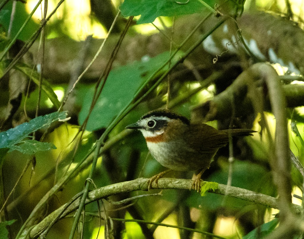
Nepal fulvetta
This inclusivity and equality of human and non-human is nothing but the core principle of bio-spherical egalitarianism. Here in Bhutan the Buddhism holds hands with Deep Ecology, thus give birth of a concept of regenerative ecotourism which does not commodify nature or any of her inhabitants. This philosophy was well resonated in my guide Sonam’s attitude towards the ecotourism offerings he had for me.
Maguri Motapung Beel is a wetland and lake located near Dibru-Saikhowa National Park and Motapung Village of Tinsukhia district in Assam. Maguri Motapung Beel serves as a natural home to wildlife and provide a source of livelihood to the local communities.
On May 27, 2020, a fountain of crude oil polluted the waters of the wetland, and it caught fire on June 9. Conditions have recovered since then, and one highlight for the Maguri Beel wetland post the disaster has been the sighting of a Mandarin Duck in the lake for the first time in 118 years.
Maguri beel in dense fog of winter morning
On 17th December, at around 5:00 PM we reached at Maguri beel. Our nature guide Palash has his own resort there. He also lives in a nearby village. After reaching there Palash took us to couple of nearby tea estates to search for brown hawk owl, oriental and collared scops owl. Eventually in the village itself we found hawk owl and in the front yard of Palash’s house we found quite a few collard-scops owl perching on trees.
Collard scops Owl
Next day as early as 5:30 in morning after a short boat ride we reached at the other side of the Maguri beel to explore the grassland which is also part of Dibru-Saikhowa National Park. There we spotted hen harrier, endangered swamp grass babbler, golden cisticola and straited babbler. Then at around 7:00 AM we went to another side of the grassland across the water body near the Baghjan village. The village is also known as the victim of one of the recent environmental disasters. A blowout, explosion, and fire lasting more than five months, from 27th May to 15th November 2020 the natural gas well of Oil India Limited (OIL) at Baghjan in Assam’s Tinsukia district has resulted in the loss of an estimated 55 % of the biodiversity in the affected Dibru-Saikhowa landscape. As many as 1,632 hectares of wetland, 523 ha of grassland, 172 ha of area covering rivers and streams, and 213 ha of forest were damaged to varying degrees.
Swamp grass babbler
During our exploration in the grassland of Baghjan, we spotted the vulnerable and elusive marsh babbler. Besides that, we also spotted dusky babbler, chestnut capped babbler and puffed chested babbler among other regular birds.
Marsh babbler
In this whole trip of Dehing, Namdapha and Maguri Beel-Dibru-Saikhowa, I saw around 100 different birds and 80% of them were spotted for the first time ever in my life. That was why it was one of my memorable biodiversity and photography trips in India. Forests of Arunachal, indeed, have much more to offer than tigers and elephants. However, the Forest Department of this country was always sounded hopeless about the forests of Arunachal Pradesh for not sighting of tigers and elephants.
Swampland between Maguri beel and Dibru-Saikhowa
Based on an article written by Rupak Goswami in 1st August 2023 edition of EastMojo, “At Namdapha Tiger Reserve (NTR) in Arunachal Pradesh, none of the Range Officers stays inside the NTR area, and the responsibility of on-the-ground protection is largely delegated to the contingency staff, who are about 150 in number, out of which 50 are part of the tiger protection force.This sensitive landscape of 1985km2 with unique biodiversity, is managed by three ranges with a very meagre staff.The infrastructure for protection, like roads, patrolling paths, anti-poaching camps and motorcycles is very poor. The tiger reserve is hit hard by encroachment issues due to the increasing populations of the Lisus and other tribes. The Lisus are expanding their areas under cultivation and cardamom has a ready market as a cash crop. As of now, it is reported that there are eight Lisu villages with 311 families occupying the critical tiger habitat.”
As per this article, the presence of elephants of late has not been reported from within NTR. We know only one tiger was reported in 2022 NTCA tiger status report. The Management Effectiveness Evaluation Report (MEE) of the Namdapha Tiger Reserve said, “it is apprehended that probably the elephant population has adversely been impacted by hunting by tribes which might have found a ready market in the neighbouring countries”.
A section of Maguri Beel sand bed
Although I said before that, forests of Arunachal have much more to offer than tigers and elephants, but one cannot deny that to protect this exquisite biodiversity, tigers and elephants are required too. Otherwise, human greed will eventually perish the biodiversity abundance of the “Land of the Rising Sun”.
Based on 2022 NTCA tiger status report of India, tigers were photo-captured for the first time in Buxa Tiger Reserve, Neora Valley National Park, and Mahananda Wildlife Sanctuary in West Bengal. Also, after quite a few years, a tiger was photo-captured in the Namdapha Tiger Reserve of Arunachal Pradesh. The report also mentions that Tiger reserves and protected areas in Arunachal Pradesh are connected through large, forested tracts and a number of reserve forests situated along the interstate border between Arunachal Pradesh and Assam.
This landscape is further connected to Intanki National Park in Nagaland and Dampa Tiger Reserves in Mizoram through some weak linkages of degraded forest. Several indigenous forest communities dependent on bush meat and forest resources for subsistence inhabit this landscape; hence, the prey base is almost depleted in many of the forests. In addition, due to its strategic location, several highways are planned in Arunachal Pradesh to provide faster access to international border areas.
Entry of Namdapha
Arunachal Pradesh gets three national highways: the Frontier Highway, the Trans-Arunachal Highway, and the East-West Industrial Corridor Highway, and six vertical and diagonal interstate highways of about 2178 km will be built. Fragmentation of habitat by this rapid infrastructure development will eventually destroy the weak linkages between the tiger habitats and might lead to the local extinction of tigers in this landscape. Substantial poaching for the illegal trade of tiger body parts and ungulates constantly threatens the tiger population in this landscape. Since the landscape shares porous international borders in many parts with neighbouring Southeast Asian countries, it is comparatively easy for poachers to operate in this landscape. In the recent past, the skin and body parts of two tigers were seized from Dibang Valley in Arunachal Pradesh and Itakhola on the Assam-Arunachal Pradesh border. Direct exploitation of tigers from this already low abundant population, coupled with habitat fragmentation and biotic pressure, could eventually deplete the tiger population in this landscape. Other than rapid development causing habitat fragmentation and the poaching of wild tigers and prey, the invasion of weeds in the natural habitat is a severe threat to this landscape.
Forest of Namdapha
The institute responsible for tiger conservation in India itself recognizes these facts behind depleting tiger population in the Dibang-Kamlang-Namdapha block of tiger landscape in Arunachal Pradesh. The state has three tiger reserves namely Pakke, Kamlang, Namdapha tiger reserve and Dibang Wildlife Sanctuary. As per 2022 tiger status survey, only nine tigers were photo-captured in this state.
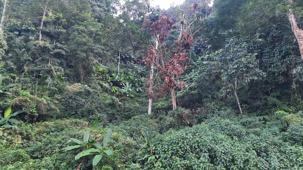
However, the status of Arunachal’s tiger population does not tell the real story of its phenomenal biodiversity resources. This state is an ecological wonder that remains largely unexplored. The tropical rain forest of the Namdapha National Park, one of India’s largest protected area, throbs with a dizzying array of flora and fauna, many of which are lesser known, hidden gems of the wild.
Devan camp of Namdapha
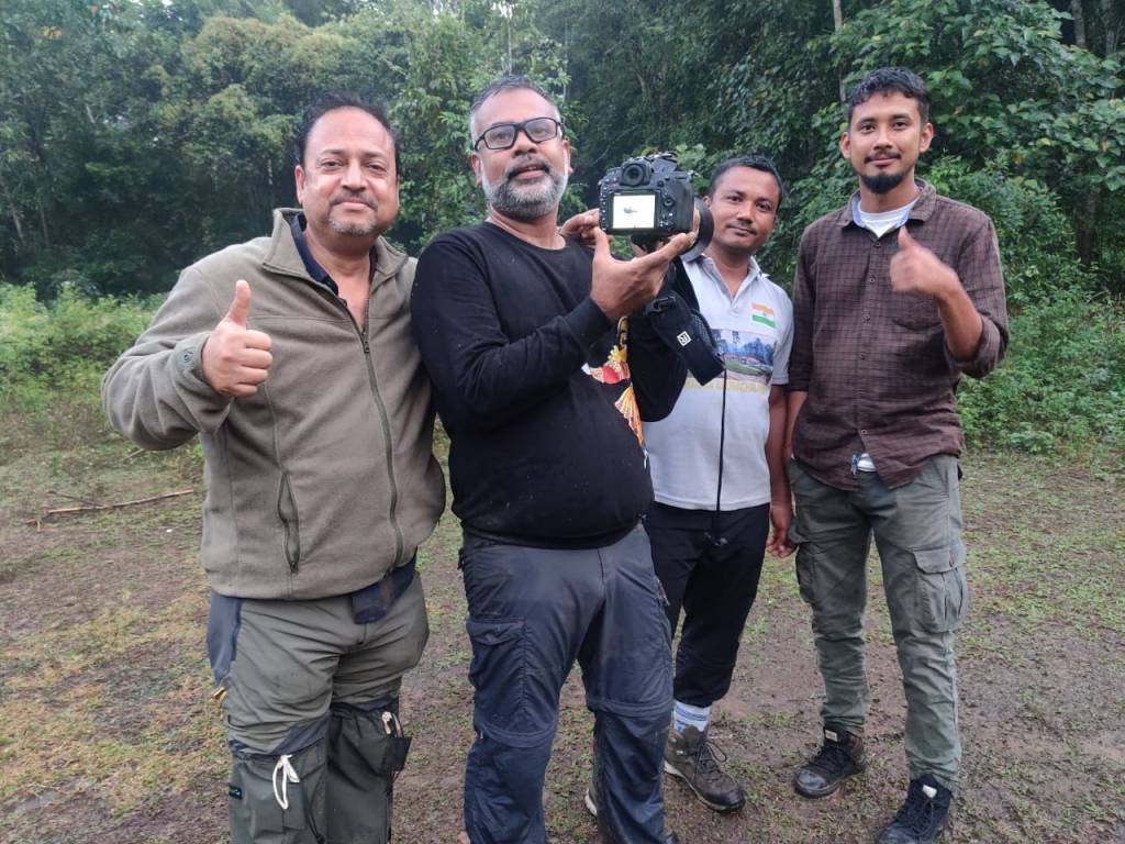
After completing our exploration in Dehing, on following day, on 14th December, at around 6:00 AM we started for Namdapha National Park and Tiger reserve, the main destination of our exploration. On the way we stopped at various village forests, ponds and water streams for bird watching. Some noteworthy sightings were – greater necklace laughingthrush and red headed trogon near exit gate of Dehing; Oriental pied hornbill feeding on banana and coconut tree in a village; pied falconet perching on a tree top and occasionally snooping for butterflies, just before the entry gate of Namdapha; and few black capped and white crowned forktails near a water stream within Namdapha. We reached at Devan Forest camp of Namdapha at around 4:00 PM. In this part of India, sun goes down by 4:00 PM and by 4:30 PM light was quite low. In the evening between 6:00 PM and 8:30 PM we did a nigh-walk within the tiger reserve to search for slow loris. We stayed in Devan camp for three nights and every night we searched for that nocturnal animal. But never succeed. Instead, every night we saw red giant flying squirrel feeding on tree bark within our campus.
Pied falconet
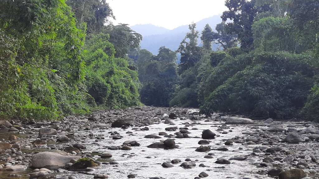
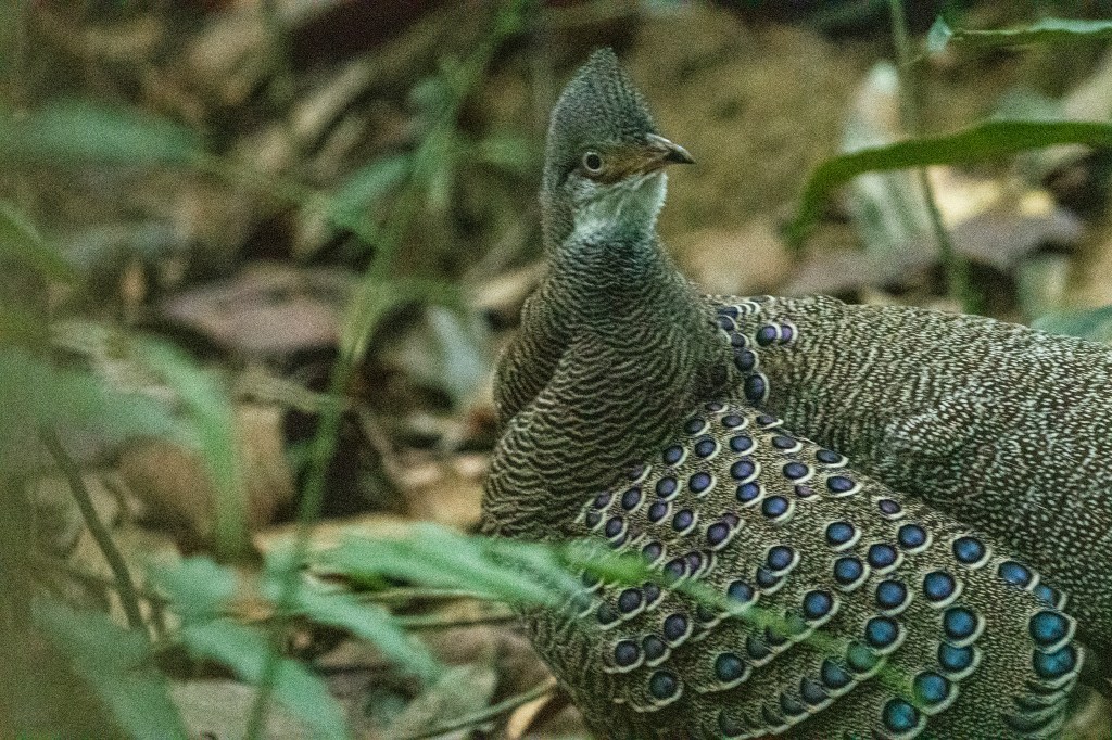
On 15th December at morning 6 o’clock we did a moderate hiking in the Haldi Bari area of the tiger reserve. From our forest camp it was three hours hike, which included crossing Nua Dehing river through a precariously constructed bamboo hanging bridge, climbing steep hillock, and walking through dense foliage. From the hoolock gibbon, the only ape species found in India, to the elusive snow Leopard and the majestic red panda, Namdapha is a living testament to the intricacies and wonders of evolution. The day was sunny, and the forest was resounded with iconic call of hoolock gibbons. This reserve is unique, not just for its lofty stature as the third largest of its kind in India but also due to the strikingly varied altitudinal range of its landscape. Ranging from 200 metres to an astounding 4,500 metres, it provides the tiger and numerous other species with an environment of unparalleled diversity.
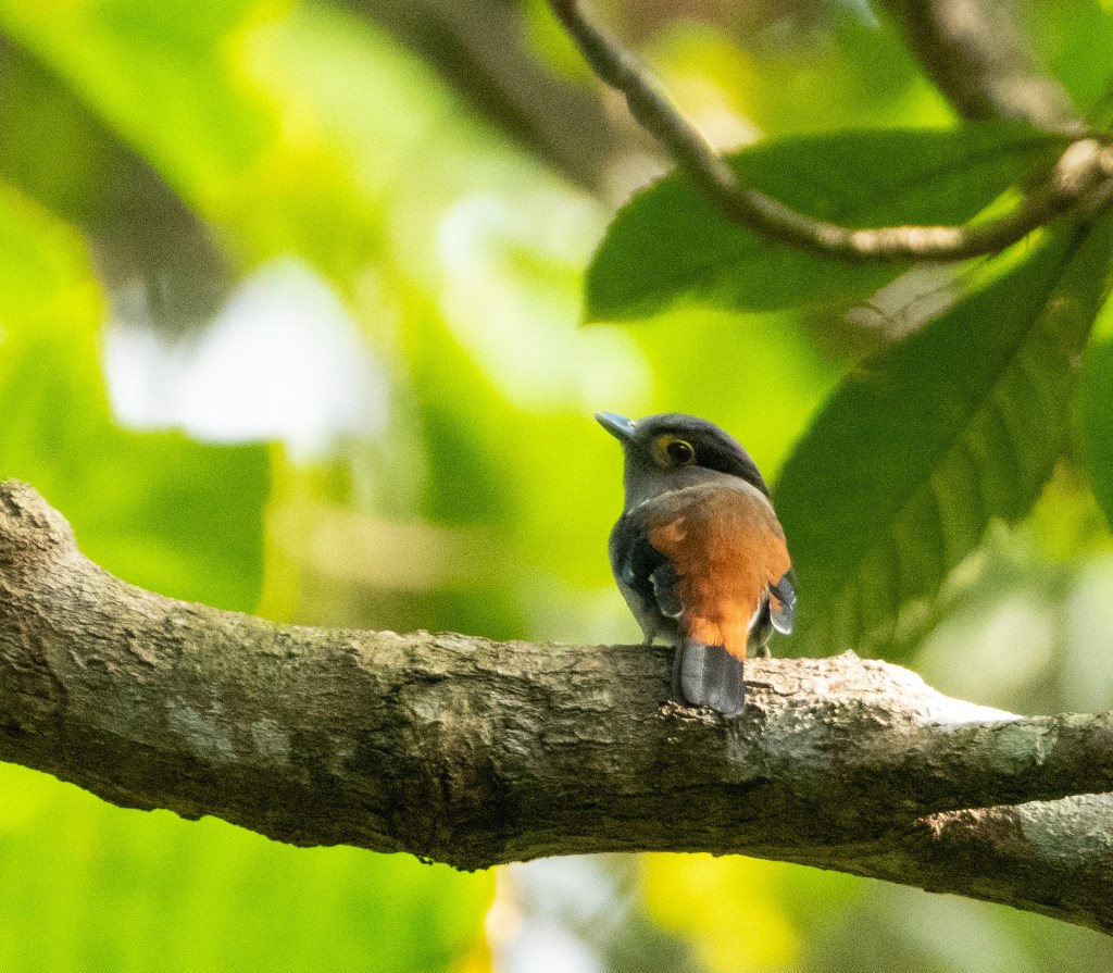
Eye-browed wren babbler
Before we returned to our camp at 12:00 noon, quite a few rare birds we spotted and shot. Some of them were slaty bellied tesia, white tailed flycatcher, streaked wren-babbler, white throated bulbul, rufus backed sibia, long-tailed broadbill, Durian redstart, and eye-browed wren-babbler. Afternoon again we explored the road goes through buffer zone of Namdapha towards Vijaya Nagar, where India ends, and Myanmar starts. Oriental hobby, rufous-gorgeted flycatcher, dark breasted rose finch, little forktail were some notable sightings. Our day ended with much delight by sighting of Oriental Bay owl, which we were trying to spot from day one.
Oriental bay owl
Next day was all about full day walk on the road passing through tiger reserve towards India-Myanmar international border. We left our camp at 6:00 AM and returned at 5:00 PM. Between Deban camp and Kamala Valley camp we spotted and identified birds like white-bellied erpornis, snowy throated wren babbler, brown crowned scimitar babbler, greater rufous headed parrot bill, white hooded babbler, hill prinia, black throated sunbird, white-rumped munia, Nepal fulvetta, pale-billed parrot bill, white browed piculet, whistling warbler, grey headed canary flycatcher, black chinned yuhina, long-tailed sibia, and mountain imperial pigeon.
pale-billed parrot bill
As per Forest Department’s norm, one local forest guide named Assam Mussang was also with us for two days in Namdapha. He told us that tourists are allowed only in selected routes in buffer zone of this tiger reserve. Rest of the forest is not even suitable for walking. Leave aside the possibility of driving car or jeep. Therefore, ecotourism activity does not happen in most of the buffer and entire core zone of Namdapha. Only forest department staffs and researchers go there for study and installing camera traps. Even forest patrolling is limited in majority part of this forest due to difficult accessibility. That is why probably NTCA was also sounded helpless in their 2022 tiger status report while explaining depleting tiger and its prey base population in Arunachal Pradesh. Assam Mussang told us that Kodwai zone is part of buffer and core, where maximum number of tiger pugmarks and camera trap images were recorded. His comment was well resonated with NTCA’s 2022 status report of recording one tiger in Namdapha.
Red giant squirrel
The day was sunny and the snow-capped Dapha bum, the highest point of Namdapha was visible from our exploration track. Despite of depleting tiger population, Namdapha stood tall with array of its magnificent biodiversity. As one steps into an era marked by climate change and biodiversity loss, Namdapha shines as a beacon of hope, a sanctuary where life thrives in its countless forms. It stands as a testament to the resilience of nature when given the chance to flourish and the power of people when they become stewards of the land. At the end of the day when we came back to our camp, the resident red giant flying squirrel was found to be feeding on tree bark. That was how my last night in India’s last tiger reserve ended with a message, “to become a splendid ecotourism destination, raining of tiger sighting is not essential. The forest has much more to offer than the tigers.”
Snow-capped Dapha boom
We left Namdapha on 17th December, towards Miao, the border town between Arunachal and Assam. Our next destination on Maguri bill which was in news because of one of the recent environmental disasters of India.
North-East landscape of India comprises the states of Arunachal Pradesh, Assam, Manipur, Mizoram, Nagaland, Sikkim, Tripura, and hilly districts of northern West Bengal. This landscape can be further classified as North Bengal Dooars, Brahmaputra flood plains, and North-East hill region. It is situated alongside international borders with Nepal, Bhutan, People’s Republic of China (China occupied Tibet), Myanmar, and Bangladesh, and connected to peninsular India through a narrow strategic stretch, Siliguri Corridor. As the landscape shares 90% of its boundary with neighbouring countries, it is one of the most important geo-strategic locations of the country. This landscape also is home to more than 200 ethnic and indigenous communities. Other than the cultural plurality, North-East and Brahmaputra flood plains landscape is diverse with natural resources.
Since the landscape shares porous international borders in many parts with neighbouring Southeast Asian countries, it is comparatively easy for poachers to operate in this landscape. In the recent past, the skin and body parts of two tigers were seized from Dibang Valley in Arunachal Pradesh and Itakhola on the Assam-Arunachal Pradesh border. Direct exploitation of tigers from this already low abundant population, coupled with habitat fragmentation and biotic pressure, could eventually deplete the tiger population in this landscape. Other than rapid development causing habitat fragmentation and the poaching of wild tigers and prey, the invasion of weeds in the natural habitat is a severe threat to this landscape.
Grey peacock pheasant at Dehing Patkai
Between 12th and 18th November of 2023, I did intense biodiversity exploration in around 400 km stretch consisting of Diban camp of Namdapha and its surrounding areas including Haldibari, Highiand and Kamala Valley camp, Dheing Patkai National Park and Maguri beel as well as adjacent grasslands of Dibru Saikhowa National Park. Around 2:30 PM, we started our journey from Dibrugarh airport and reached at our homestay in Digboi at 6:00 PM. I was with a reputed bird watching guide of North-East, named Palash Phukan. I was also joined by another experienced bird photographer from Pune, named Suyog Ghodke.
Dehing Patkai exploration team
As per schedule, after reaching close to our homestay in Digboi, we went to look for Oriental Bay owl in the forest of Dehing. Dehing Patkai National Park harbours the largest stretch of lowland rainforests in India. The rainforest stretches for more than 575 km2 in the districts of Dibrugarh, Tinsukia and Charaideo. The forest further spreads over in the Tirap and Changlang districts of Arunachal Pradesh. The Wildlife Sanctuary was also declared as Dehing Patkai Elephant Reserve under Project Elephant. After reaching at a particular patch of dense forest, which was apparently not allowed to be explored on foot, Palsh started playing call of bay owl. Within few seconds the bird started responding to that call from a nearby tree. However, before spotting the bird, Palsh’s torch light caressed through an elephant like object. In the darkness it was not possible to distinguish that object clearly from the large tree trunks in background. Nevertheless, an elephant head like curvature was vaguely noticed in torchlight.
That unclear vision mixed with fear and imagination was enough to make all of us run for our dear life and get inside the car parked around 100-200 meters away from the forest patch. Elephant is the main reason why exploring Dehing’s forest in foot in darkness is not allowed.
Ashy headed green pigeonat Dehing
Next day, we started at 6:00 AM and continued till lunch break at 1:30 PM. It was all bush walking, ascending, and descending through dense foliage of Dehing Patkai rainforest. Within an hour of our morning exploration, we got to see a male grey peacock pheasant. When we were busy in shooting that bird from quite proximity, our driver Guru sent an SOS of elephant alert through walkie-talkie to Palash. He saw a male elephant standing behind our car which was parked on the forest path and upon noticing Guru it entered deep forest, where we were busy with peacock-pheasant. Therefore, another run for the life for us and that was bit difficult and far scarier than the previous one. That time the sighting of elephant was real and forest path was more hostile because of thorny bush, thick foliage, and muddy path.
Rufus throated fulvetta at Dehing
Somehow, we came out of dense forest and reached where our car was parked. It was time for breakfast after few hours of intense bird-walk. Rest of the morning we did easy to moderate hike in the forest and spotted various birds which were first in life sighting for me, such as grey peacock-pheasant, pale capped pigeon, rufus throated fulvetta, chestnut backed laughing thrush, silver breasted broadbill, ashy headed green pigeon, blue-winged leaf bird, red headed trogon, and white spectacled warbler.
Grey-lored broadbill at Dehing
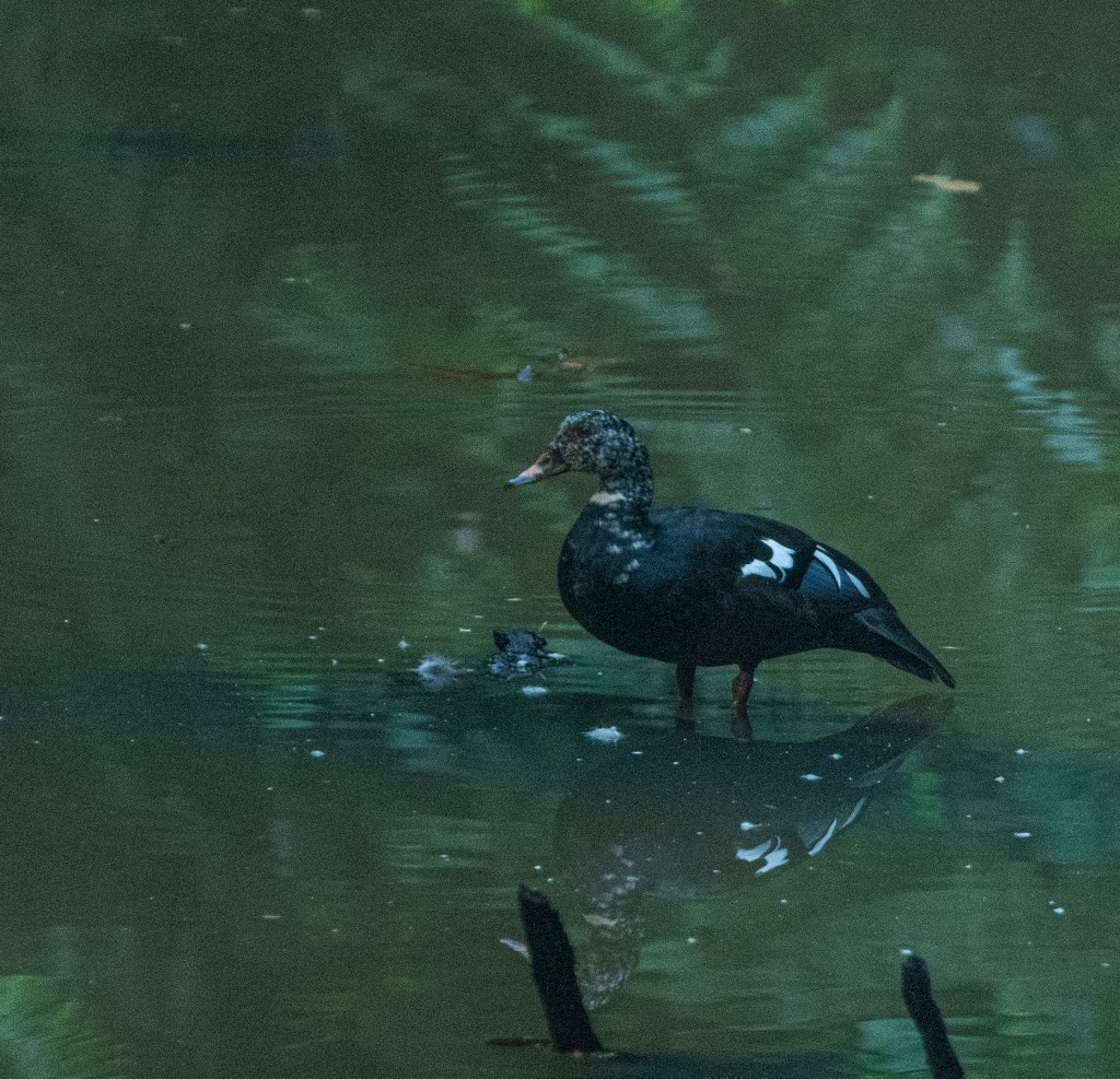
The most exciting exploration in Dehing happened on that afternoon. After a sudden heavy shower, the forest path was muddy and slippery. Therefore, ascending and descending on steep slope became quite difficult. After couple of hours’ physical effort, surviving fear of fall risks, and few actual falls on forest path we reached near a pond and were delighted by a sighting which we would like to cherish for ever. It was a male white-winged wood duck, the state bird of Assam. Decaled as Endangered by IUCN, historically, the white-winged duck was widely distributed from North-Eastern India and Bangladesh, throughout South-East Asia to Java and Sumatra. It is now extinct in Java. In India, the duck is found only in the North-Eastern part of the country, with the main concentration in Eastern Assam and adjacent areas of Arunachal Pradesh. However, in 2002 it had a population of only 800, with about 200 in Laos, Thailand, Vietnam, and Cambodia, 150 on Sumatra, notably in Way Kambas National Park and 450 in India, Bangladesh, and Myanmar. Due to ongoing habitat loss, a small population size, and because this duck is hunted for food, eggs and pets, the white-winged duck is evaluated as Endangered on the IUCN Red List of Threatened Species. In India, the key protected areas for the white-winged duck are Dibru-Saikhowa National Park, Dehing-Patkai Wildlife Sanctuary, Nameri National Park and Namdapha National Park. The white-winged duck occurs in dense tropical evergreen forests, near rivers and swamps.
The elusive white winged wood duck at Dehing – state bird of Assam
Dehing-Patkai as a potential wildlife sanctuary was identified in late 1980s during a primate survey as “Upper Dehing Wildlife Sanctuary”. Subsequently during a study on white-winged wood duck in early 1990s, it was discovered as a globally important site for this duck and recommended to be upgraded to “Upper Dehing National Park”.
After white-winged wood duck sighting for nearly two hours we again went for bay owl when it was dark. But fear of elephant in mind did not let Palash and us to focus on that bird. Therefore, we called it a day and returned to our homestay.
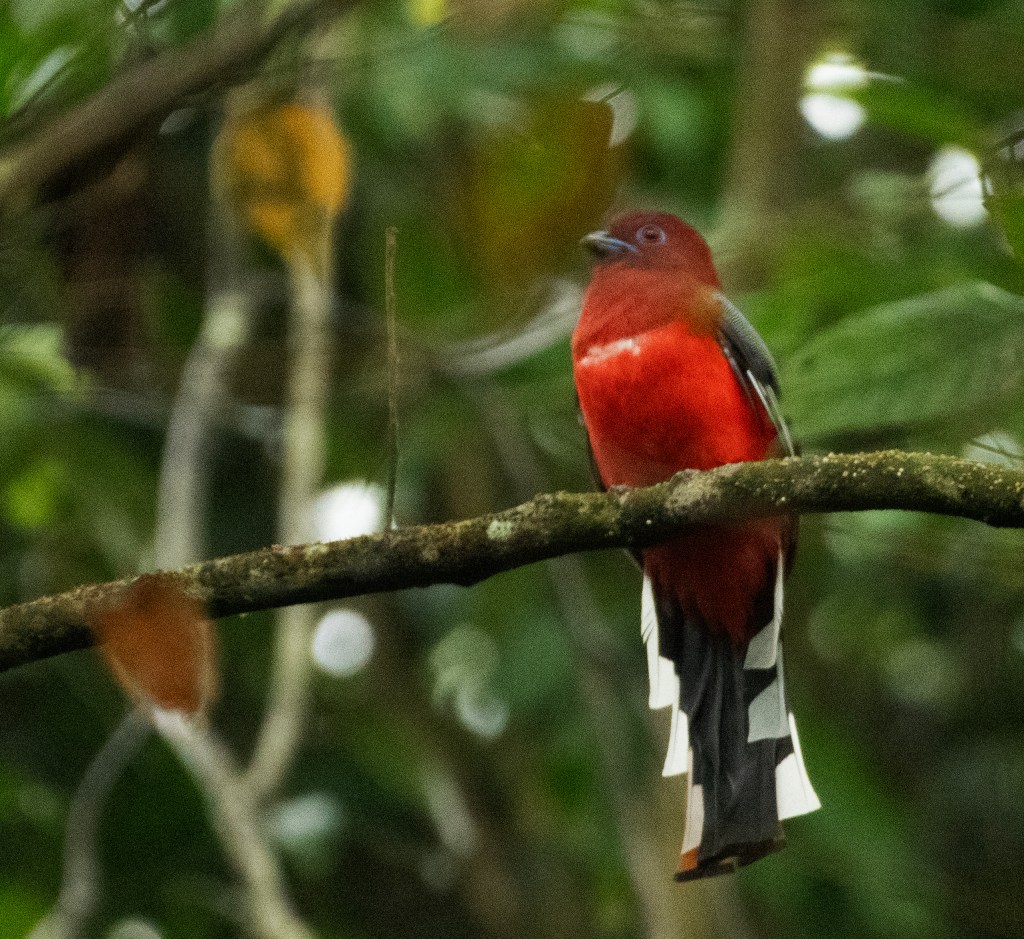
A male red headed trogon at the exit gate of Dehing Patkai National Park
Our next destination was Namdapha Tiger Reserve of Arunachal Pradesh!